


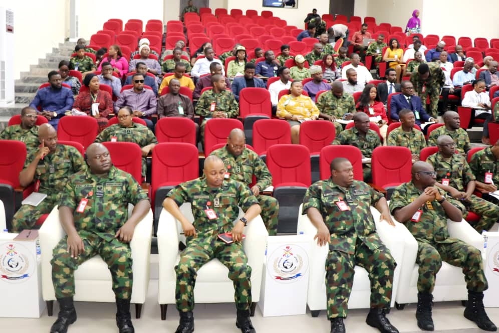
The Chief of Defence Space Administration Air Vice Marshal AA Shinkafi commends the Directorate of Earth Observation (DEO) on its successful monthly lecture with the theme; “ Geospatial Technology: A crucial component of the Armed Forces and National Security” . The DSA Monthly Lecture Series held on Thursday 26 October 2023, at the Irabor Hall is part of the ongoing efforts by the Administration to boost the operational capabilities of Staff and personnel in human resource development to appropriately respond to contemporary and emerging security threats. The Monthly Lecture Series has stood the test of time as one of the major activities of the Administration geared towards the enhancement of capacity building and fulfilling the DSA mandate which is to provide space solutions and assets to support the Armed forces of Nigeria (AFN) and other Sister Agencies in peace and war time.
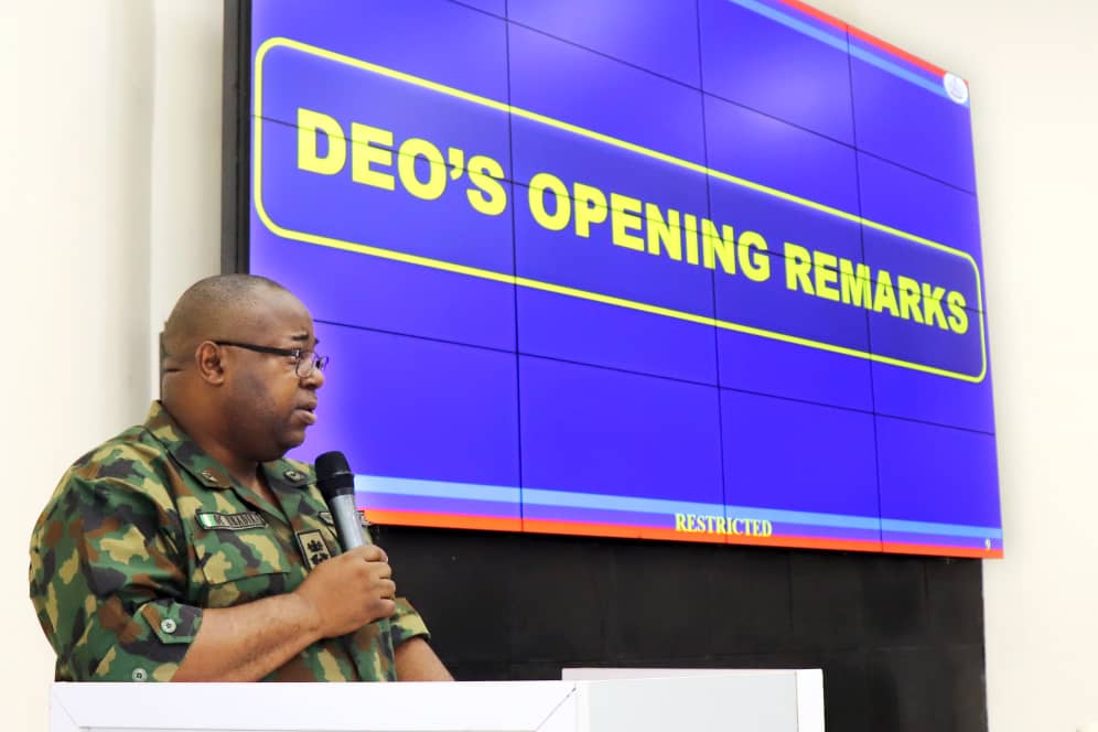
The seminar kick-started with the opening remarks by the Director of Earth Observation, Air Commodore OC Ubadike. In his remarks, he quoted one of Margaret Fuller’s famous quotes “If you have knowledge, let others light their candles in it.” In essence, he buttressed the importance of sharing knowledge. Air Commodore Ubadike stated that Data gathered by the satellites are used as Geospatial tools to analyse the data in order to make meaning of it. He noted that Geospatial technology in summary was all about Data acquisition, Digital Terrain models and Data analysis processing. He averred that the seminar marks a significant milestone in the continuous efforts of DSA to provide assets and solutions in enabling the AFN achieve success in operational grounds, adding that the collective knowledge and expertise at the seminar would generate actualization of a robust and capable DEO.
In addition, Air Commodore Ubadike stated that the effective application of the Geospatial technology has helped militaries globally and is also helping our own military to wedge effective war against terrorists, insurgents and other forms of criminalities. This was closely followed by the lecture on “Geospatial Technology: A Crucial Component Of The Armed Forces And National Security” presented by the resource person Mr. Tersur Hagher, an expert in Remote Sensing and Geospatial Data Analysis with certifications in the use of ArcGis Pro for Geospatial intelligence analysis and workflows. The presentation covered the historical background and development of Geospatial technology, how modern technology has evolved over time, components and products of Geospatial technology, application of the technology in relation to the Armed Forces and National security. He also mentioned techniques adopted by the Directorate while utilising geospatial technology and challenges it faces with regards to the full optimization of this technology.
Furthermore, Hagher made emphasis on the Armed Forces responsibility to protect the nation’s sovereignty against internal and external aggression hence the need for Geospatial technology and intelligence to collect, manage, analyse and visualize data that has spatial components. This analysis provides a comprehensive understanding of geographical features which could be used to assess enemy activities, plan military operations, support intelligence and reconnaissance efforts. He expedited the use of Geospatial technology to the Armed forces using the remote sensing process, Hagher stated that after acquiring images from Delsat 1, preprocessing it by the Mission Planning Unit, conducting geospatial analyses by the Geo-Intelligence Laboratory Unit and the Interagency Fusion Center, the end point is Geospatial intelligence (GEOINT) which is the analysis and visual representation of information about the Earth’s surface and its geographic relationships. Hagher enumerated the contributions of the DEO to Geospatial intelligence, map development and production for the AFN, cutting across different states and institutions of the country.
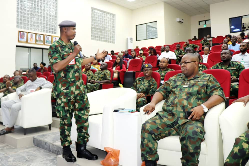
The interactive session was moderated by Commander M Garba, with discussants which include; Major AO Kilani, Mr. Mahdi Ibrahim, as well as the Presenter, Mr. Tersur Hagher. The session gave the staff present ample opportunity to ask questions, clear grey areas, make contributions and as well as additional points from experts in the field of Geospatial technology.
The Chief of Defence Space Administration (CDSA), Air Vice Marshal Ahmed Abdullahi Shinkafi in his closing remarks commended the presentation by DEO for such concise and educative lecture. He encouraged members of staff of the Administration to be patriotic and committed to nation building. In his speech he affirmed his commitment to the development of staff to ensure that they deliver maximally in their assigned duties. The CDSA stressed concern over the attitude of staff who were beneficiaries of foreign courses but rather than return to the Administration and contribute their own quota towards capacity building chose to “japa”, (a Yoruba word meaning to escape or to flee) a new trend driving Nigerian youths to study abroad or go for seminars and flee from there instead of returning to contribute their own quota to the Administration and the country. Speaking further on this, the CDSA reiterated that this could be quite discouraging and challenging. However, the CDSA assures staff of DSA on his commitment towards capacity building which he said was dependent on available resources.
The programme was brought to a close with a vote of thanks delivered by Miss Suad Busari, a civilian staff of the Directorate, she appreciated the CDSA for his ever-growing support and commitment to the growth and development of the Administration and the members of staff.


